Ecosystem restoration
Saltmarsh Project
Thirteen partners and six artists working for over three years to survey, restore and communicate saltmarsh life along the Dart Estuary. Sharing river knowledge, finding paths to understanding and action for communities of interest along the way.

Helping to protect this vital ecosystem and carbon store
You might be surprised to hear that saltmarshes absorb and lock away more carbon than equivalent areas of any type of forest. And yet more than 85% of England’s saltmarsh has been lost in recent centuries to development and changing land use, and more is at risk through rising sea levels and climate change.
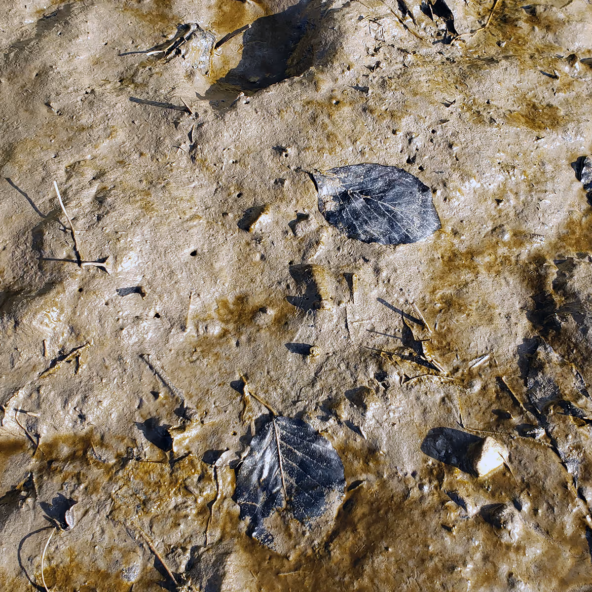
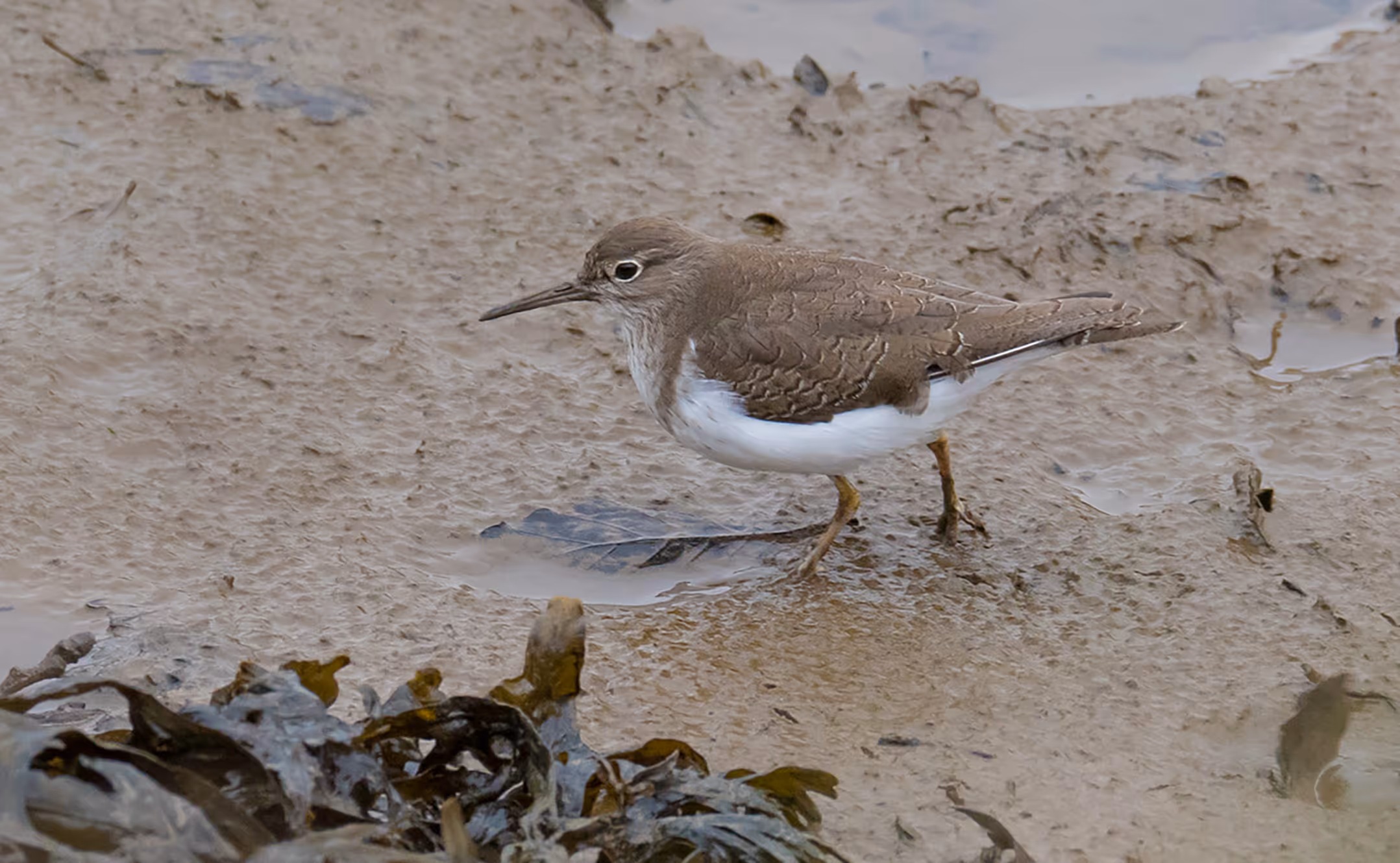
Muddy, grey and brown in the winter, the Dart's saltmarshes often go unnoticed. But they are fragile and sensitive communities full of flowering plants and creatures despite being regularly flooded by the saltwater tides. Saltmarsh plants grow along the upper shorelines of the estuary—a surprisingly harsh habitat. They absorb tidal and wave energy and help prevent flooding. They regulate water quality by absorbing excess phosphates and nitrates in river water as well as salt from the incoming tides. They are important places for wading birds to breed, spend the winter and stop off during migration. Saltmarshes are essential.
Every part of a river, like every part of our body, has a role to play in keeping us healthy. And as with the human body, what we put into it finds its way downstream, washes up on shore and then out to the sea.
For the Love of Saltmarsh
See the whole story of The Saltmarsh Project. This very short film portrays the Dart's constellation of saltmarshes and encapsulates everything you might want to know–the habitat, why it’s ‘useful’, how it makes us feel, the people involved, and how understanding leads to valuing and conserving.
Fascinated by saltmarshes?
Keep updated on saltmarsh restoration in South Devon's estuaries. Keep connected with our seasonal newsletter and you'll be the first to know when BLC hosts new saltmarsh-related activities or bioregional events.
Ecological restoration in action
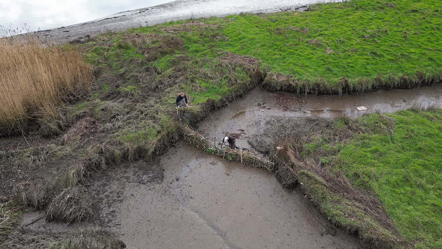
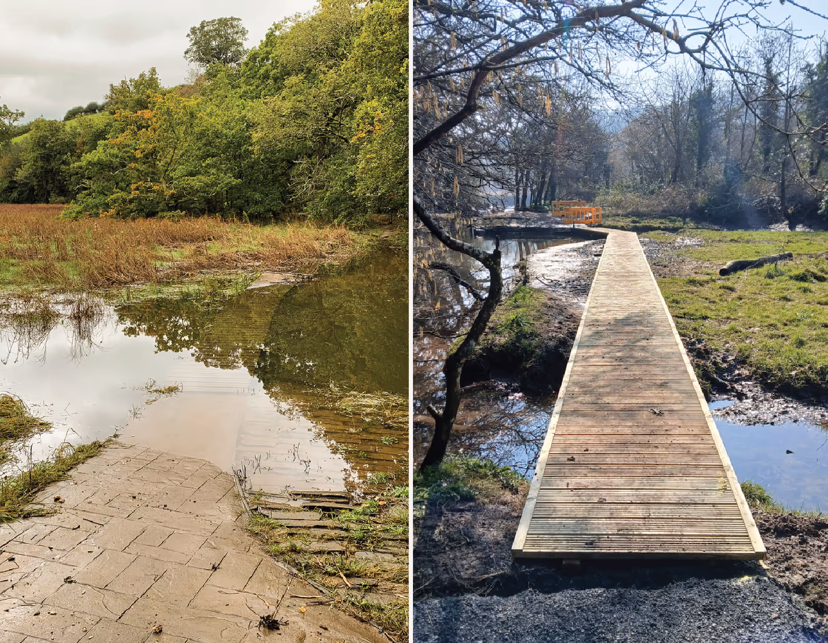
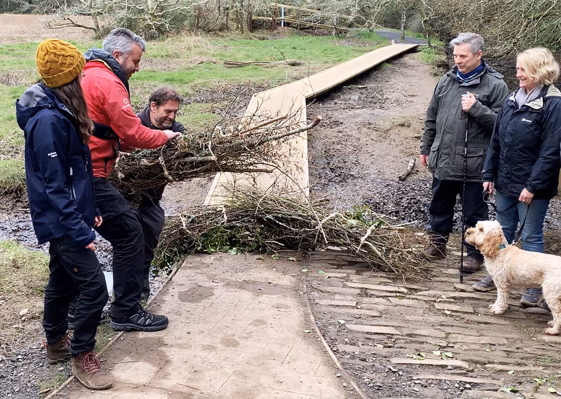
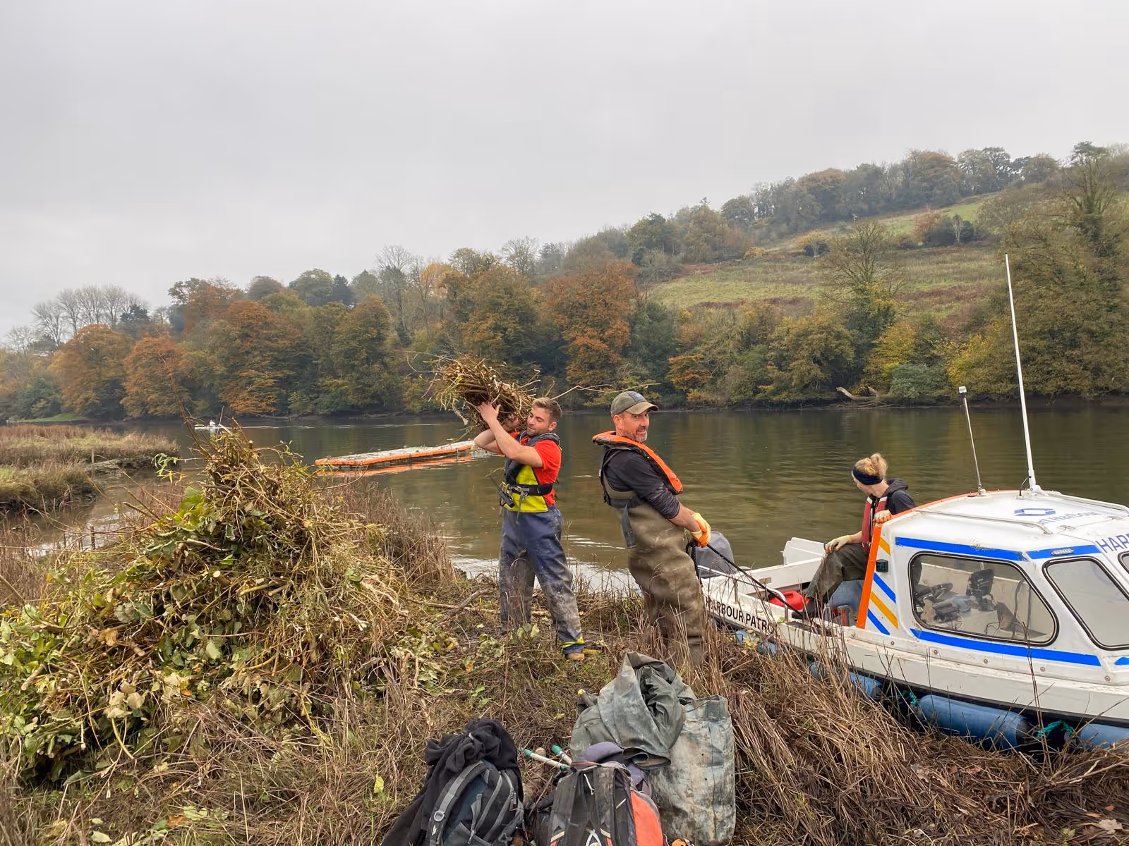
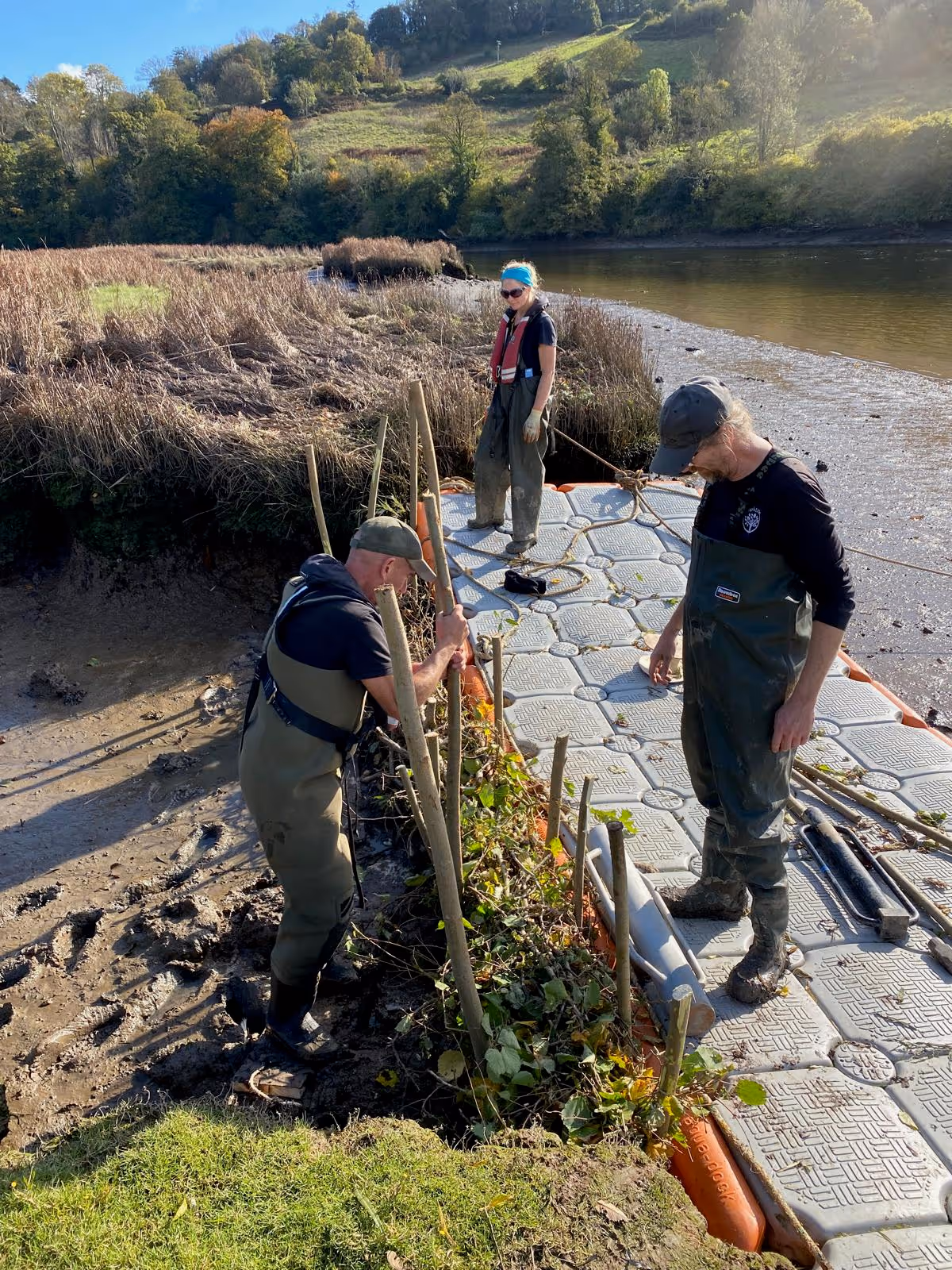
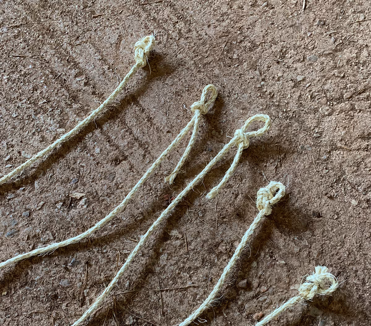
The Saltmarsh Project has delivered 4 hectares of restored saltmarsh. Restoration techniques have been trialled along a string of saltmarshes on the Dart from Longmarsh to Sharpham Point and the work is ongoing. Volunteers and trainees helped make bundles of locally coppiced willow and hazel, tied together with sisal and staked into the mud across gullies. This slows the flow of the tidal waters, helping to build up sediment over time, establishing the conditions that support the saltmarshes to flourish. The Project has also delivered a new boardwalk at Longmarsh and the repair of a section of Napoleonic stone wall at Sharpham. The aim is twofold: to help saltmarshes maintain their own natural processes and ecological function, and to produce a range of ways for nearby communities to appreciate their value. The work is funded by the Environment Agency.
Download the interpretation sign graphic
.avif)
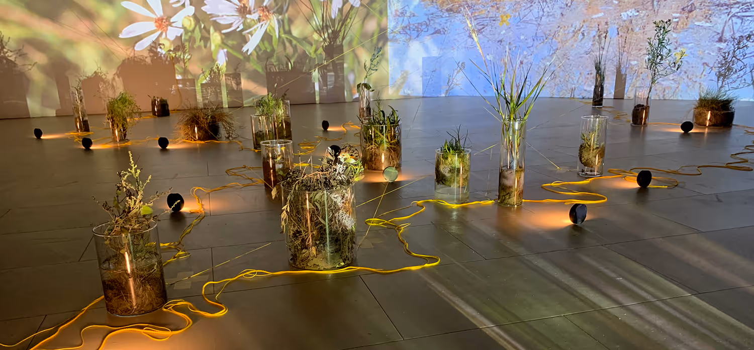
Art meets ecology
A unique aspect of this conservation work is its intentional integration of art and science. The Project invited a diverse group of local artists to create interpretive works inspired by their personal experiences of the saltmarshes. These include Ivan Grieve's mixed-media explorations, Christian de Sousa's soundscapes, and Clare Parker's tidal dance films Flux and Suspire. Throughout the Project, artists and ecologists, paired together, have shared their roles and accomplishments at celebratory events hosted by BLC.

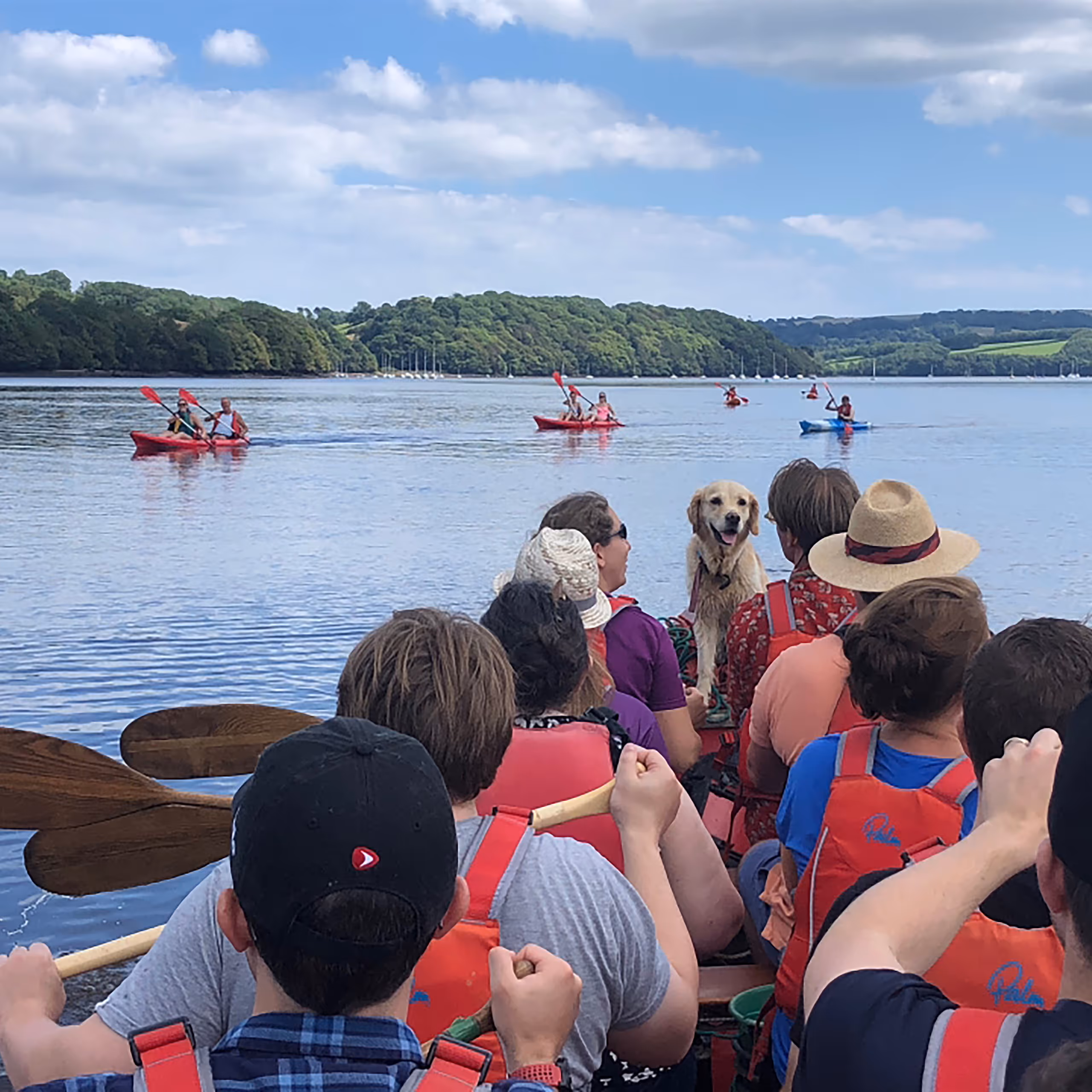
Community participation and future vision
The Project has involved local communities through talks, boat trips, events, artist-led invitations and volunteer opportunities. An early poll of 84 Dart residents indicated strong support for actions such as interpretive signage (78.5%), media resources (72.5%), and guided marsh encounters (71.2%), which the team has successfully delivered.
Looking ahead, development pathways for collaborative ecosystem restoration include storytelling and media production, evolving the arts-led track as a contribution to the UK Saltmarsh Forum platform, trialling different restoration techniques 'with nature', on-going monitoring on the Dart, and assessing other saltmarshes in the bioregion (Yealm, Avon, Kingsbridge/Salcombe, Erme). BLC is currently looking at how a wider estuary context, to include multiple habitats and communities, fits with current action planning for 'Joined up Action for Climate and Nature'.
Described as 'what happens when BLC steps in', BLC's role in The Saltmarsh Project demonstrates what bioregioning looks like on the ground: ecologically and socially important, inviting, visible, ambitious, with long-term commitment.

.avif)
Our shared journey of restoration
Ongoing
Sep 2025
For the Love of Saltmarsh
Our film embodying the whole project was shared at the UK Saltmarsh Forum along with an art installation that speaks to human and environmental connectivity.
Ongoing
Mar 2025
No more boots in the mud!
The official opening of the new Longmarsh boardwalk, celebrated by the moving of bundles to be used downstream.
Ongoing
Dec 2024
Over 600 bundles staked
Work continues through the winter. Dart Harbour transports bundles and the ParkLife crew stakes them into the mud.
Ongoing
Dec 2024
Boots in the mud
Active restoration launched at priority sites like Fleet Mill Creek, using natural leaky dam techniques. Volunteer program established for making willow and hazel bundles to be staked across gullies.
Ongoing
Jul 2024
Project alliance
Formalised joint partnership between EA, Dart Harbour, Duchy of Cornwall and BLC. UK Centre for Ecology & Hydrology joined to model sea-level rise resilience strategies.
Ongoing
Mar 2024
Art illuminates ecology
The Saltmarsh Artist Collective previewed their films at a multimedia event at Totnes Cinema, blending science with creative storytelling to engage new audiences.
Ongoing
Jun 2023
Science meets local knowledge
Comprehensive surveys completed across 8 saltmarsh sites including Longmarsh, Home Reach and 40'Off. Devon Biodiversity Records Centre integrated historical maps + drone imagery to track habitat loss since 1843, informing goals.
Ongoing
Mar 2023
84 voices shape the future
Resident survey revealed top priorities: interpretive signage (78.5% support), Dart Charter advocacy (73.8%), and guided marsh encounters. Insights directly informed Phase 3 public programming.
Ongoing
Mar 2023
Saltmarsh as climate ally
Featured at Sustainable South Hams’ Rivers Assembly, highlighting saltmarshes’ carbon sequestration power. BLC’s River Dart Charter recognised as a catalyst for catchment-scale collaboration.
Ongoing
Mar 2023
Saltmarsh wisdom shared
Sold-out talk with ecologist Nigel Mortimer, Dr. Sarah Collins, and bird expert Mike Langman. Discussions bridged bird ecology, mudflat ecosystems, and community-led stewardship, with Sharpham Trust presenting hay meadow restoration synergies.
Ongoing
Jan 2023

A foundation for collaborative restoration
The project began with getting to know the saltmarshes, project partners and the community of interest out on the river. Early focus on botanical surveys and mapping to identify priority sites.
A learning journey at the crossroads of art and ecology
Let the voices of ecology experts and local artists guide you on an exploration of these precious and fragile ecosystems, offering insights into thos different restoration approach. Watch the five pieces created by The Saltmarsh Project Artist Collective… very personal explorations of these special places.
For the Love of Saltmarsh
See the whole story of The Saltmarsh Project. This very short film portrays the Dart's constellation of saltmarshes and encapsulates everything you might want to know–the habitat, why it’s ‘useful’, how it makes us feel, the people involved, and how understanding leads to valuing and conserving.
Expert Panel: Living Dart and Saltmarsh Conservation
Recorded discussion featuring Nigel Mortimer, Dr. Sarah Collins, and Mike Langman on the importance of the Dart's saltmarshes.
Expert Panel: Living Dart and Saltmarsh Conservation
Recorded discussion featuring Nigel Mortimer, Dr. Sarah Collins, and Mike Langman on the importance of the Dart's saltmarshes.
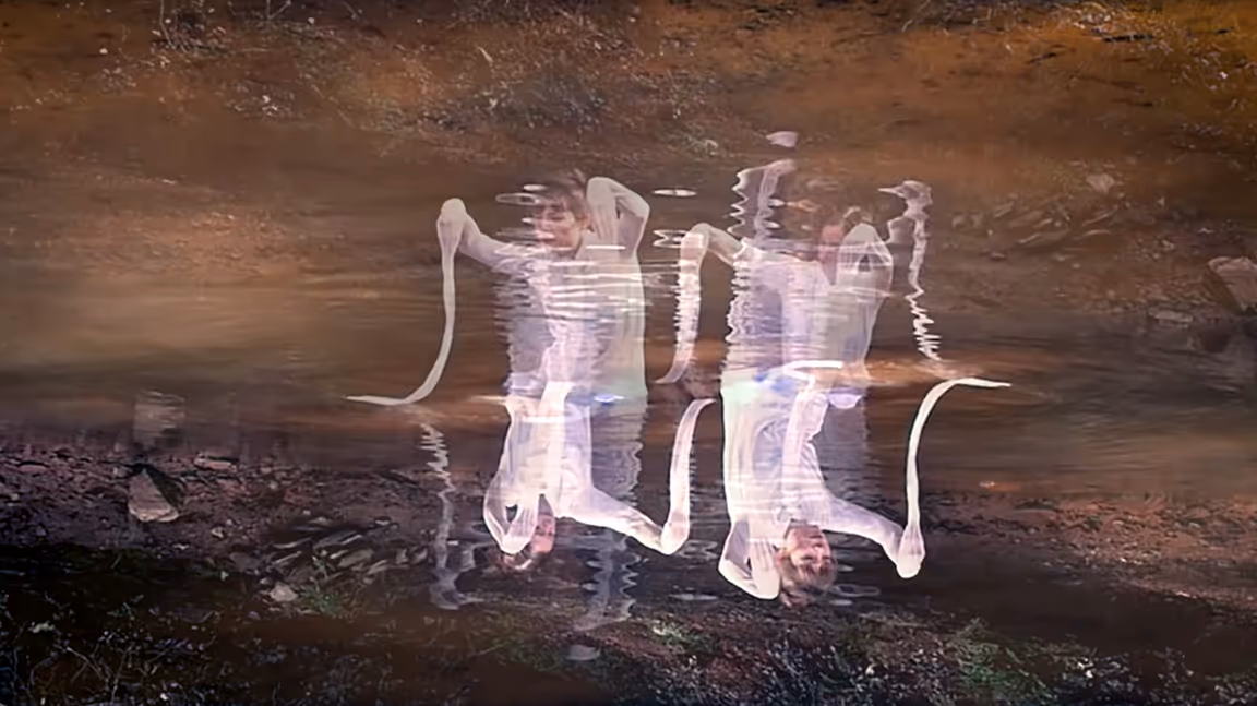
Flux
Artists Clare Parker & Jade Willows (2024)5-minute dance film with audio
Flux
Artists Clare Parker & Jade Willows (2024)5-minute dance film with audio
Systems + Flow
SYSTEMS: How can appreciating the Dart’s unique ecosystem help us learn about climate resilience?
FLOW: How does local dance artist and producer Clare Parker draw inspiration from such a vulnerable and yet resilient place to inspire her work?
Systems + Flow
SYSTEMS: How can appreciating the Dart’s unique ecosystem help us learn about climate resilience?
FLOW: How does local dance artist and producer Clare Parker draw inspiration from such a vulnerable and yet resilient place to inspire her work?
Tidemark
Artist Beth Heaney (2024)5-minute visual art film with voiceover
Tidemark
Artist Beth Heaney (2024)5-minute visual art film with voiceover
Lines + Data
LINES: How do regular visits to the saltmarsh help local arts practitioner Beth Heaney to build a picture of the life of the saltmarshes?
DATA: How does a coastal specialist use all the information gathered so far–what is the deliverable for this phase of the project?
Lines + Data
LINES: How do regular visits to the saltmarsh help local arts practitioner Beth Heaney to build a picture of the life of the saltmarshes?
DATA: How does a coastal specialist use all the information gathered so far–what is the deliverable for this phase of the project?
Where the Rivers Meet the Sea
Artist Christian de Sousa (2024)5-minute sound art piece–an extract from a 30-minute DJ mix
Where the Rivers Meet the Sea
Artist Christian de Sousa (2024)5-minute sound art piece–an extract from a 30-minute DJ mix
Ecology + Music
ECOLOGY: What does an ecological scientist look for when evaluating the condition of the Dart’s saltmarshes?
MUSIC: How does local artist DJ and photographer Christian de Sousa draw inspiration from such an unusual place to inspire his work?
Ecology + Music
ECOLOGY: What does an ecological scientist look for when evaluating the condition of the Dart’s saltmarshes?
MUSIC: How does local artist DJ and photographer Christian de Sousa draw inspiration from such an unusual place to inspire his work?
A Marshy Place
Artist Ivan Grieve (2024)2-minute collection of 2D mixed media works
A Marshy Place
Artist Ivan Grieve (2024)2-minute collection of 2D mixed media works
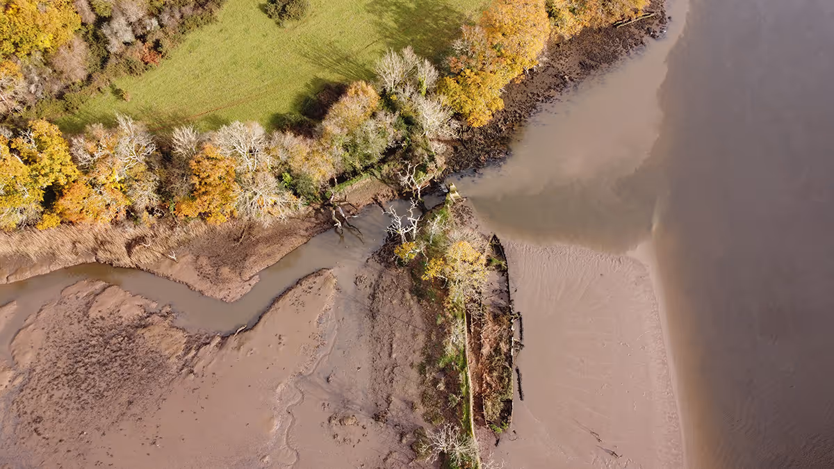
Land + Place
NEAR: How is it possible to see the saltmarshes from the air in order to show how much saltmarsh there used to be, and how much there could be?
FAR: How does local generative artist Emilio Mula use creative technology to reveal what’s hidden in the saltmarshes?
Land + Place
NEAR: How is it possible to see the saltmarshes from the air in order to show how much saltmarsh there used to be, and how much there could be?
FAR: How does local generative artist Emilio Mula use creative technology to reveal what’s hidden in the saltmarshes?
Synesthesia
Artist Emilio Mula (2024)4-minute visual generative art film/audio
Synesthesia
Artist Emilio Mula (2024)4-minute visual generative art film/audio
Near + Far
NEAR: How is it possible to see the saltmarshes from the air in order to show how much saltmarsh there used to be, and how much there could be?
FAR: How does local generative artist Emilio Mula use creative technology to reveal what’s hidden in the saltmarshes?
Near + Far
NEAR: How is it possible to see the saltmarshes from the air in order to show how much saltmarsh there used to be, and how much there could be?
FAR: How does local generative artist Emilio Mula use creative technology to reveal what’s hidden in the saltmarshes?
Saltmarsh Project Launch News Release
Official announcement detailing the project's inception, partners, and initial goals.
Summer of Saltmarsh 2024 Events Guide
Comprehensive leaflet outlining upcoming events and educational opportunities related to saltmarsh conservation.
Protecting Local Saltmarsh: A Stakeholder's Manual
Devon Wildlife Trust's comprehensive guide for individuals and organizations involved in saltmarsh preservation.
Onsite Interpretation Panel
Saltmarsh Partnership News Release
Saltmarch Activity Poll
Saltmarsh Events Leaflet
Thriving Marsh
A stakeholders manual for protecting local saltmarsh

